
We turn geospatial data into clarity
Every organisation creates huge amounts of information. Too often it is scattered across systems and nowhere near as useful as it should be. We fix that, by connecting people, places and information.

Information, made useful
Why
We make maps, geography and geospatial data clear, accessible and useful, turning them into insight, shared knowledge and practical tools that support better decisions and lasting outcomes.
Who
Founded by experts in information management and senior-level decision support, with our origins in organisations that own and operate assets. We set requirements and lived with the results before we advised anyone else.
How
Through strategic leadership and mentoring, geospatial intelligence, spatial data infrastructure, GeoEnabled digital twins, training and global competency frameworks, built on open standards.
We are proudly independent and work worldwide across architecture, engineering, construction, and asset ownership and operation, for every type of infrastructure and for government property. We are based in the United Kingdom and support clients across EMEA, the Americas and APAC.
From spatial data to site navigation


In 2012 Argent engaged GeoEnable to set the information and GIS strategy for one of Europe's largest urban regenerations: 67 acres of brownfield land beside King's Cross and St Pancras.
Argent had asset maps and plans but no practical way to share them or keep them current through constant project phases: over twenty project managers, a wide range of contractors and consultants, and asset data that changed every week.
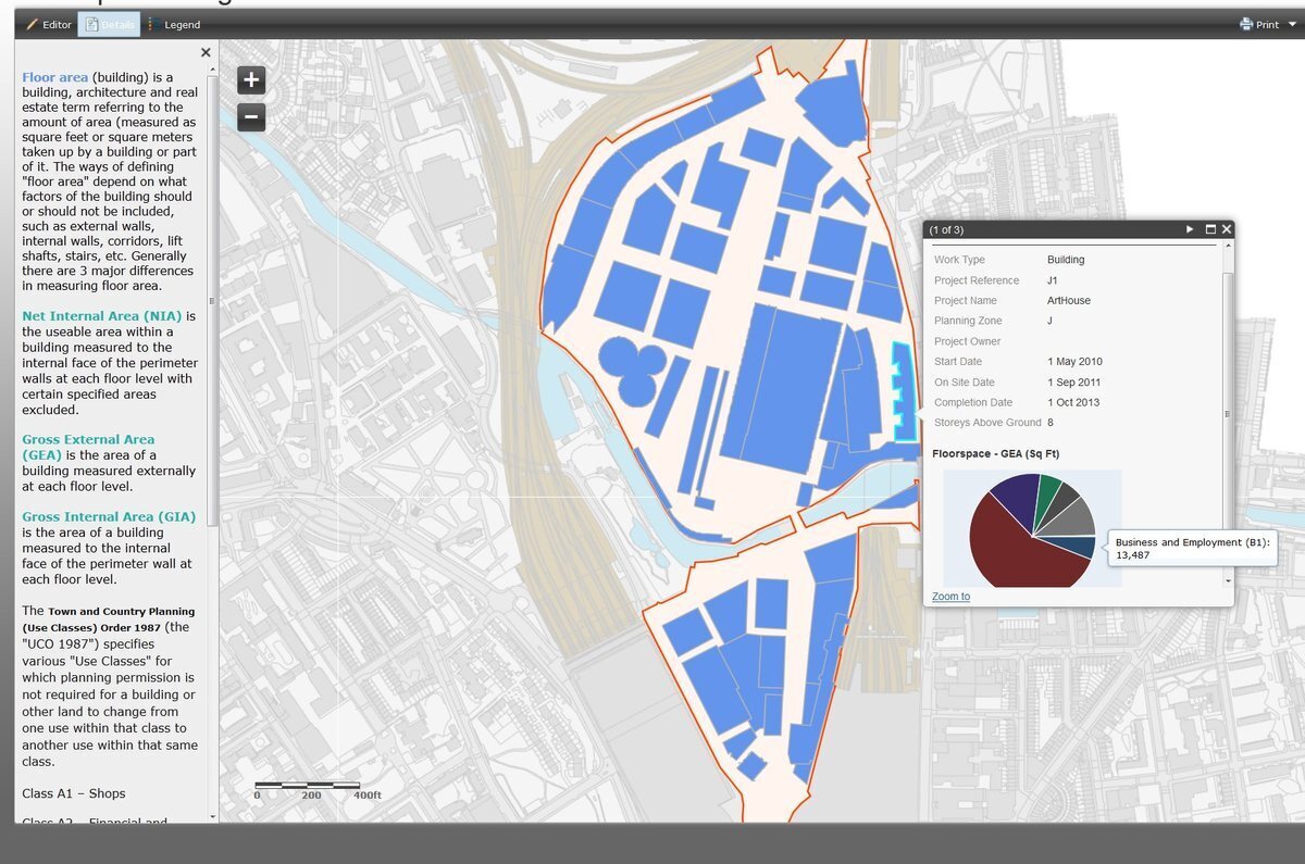
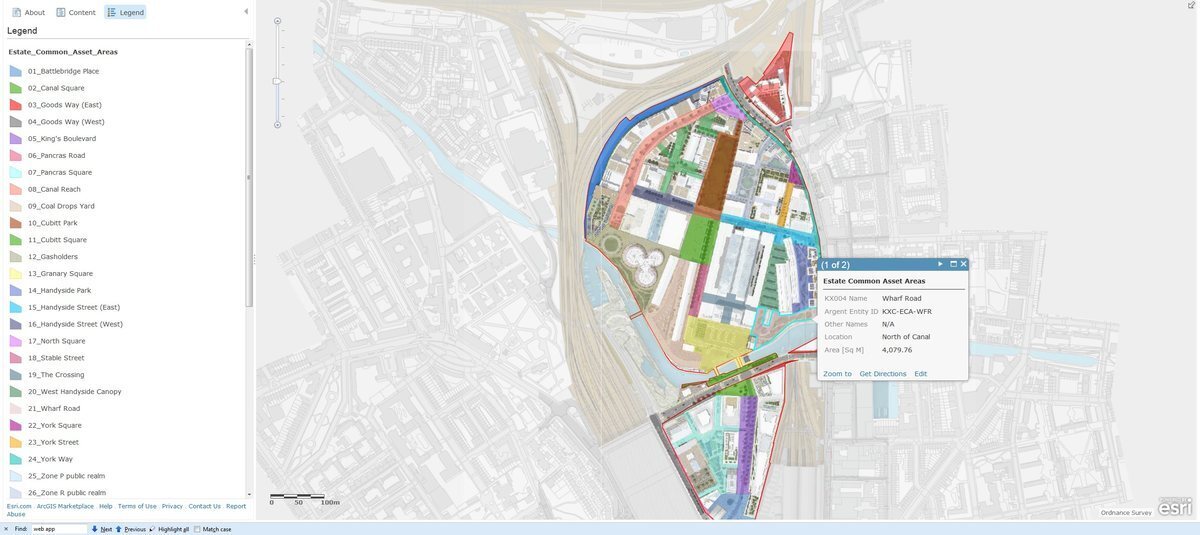
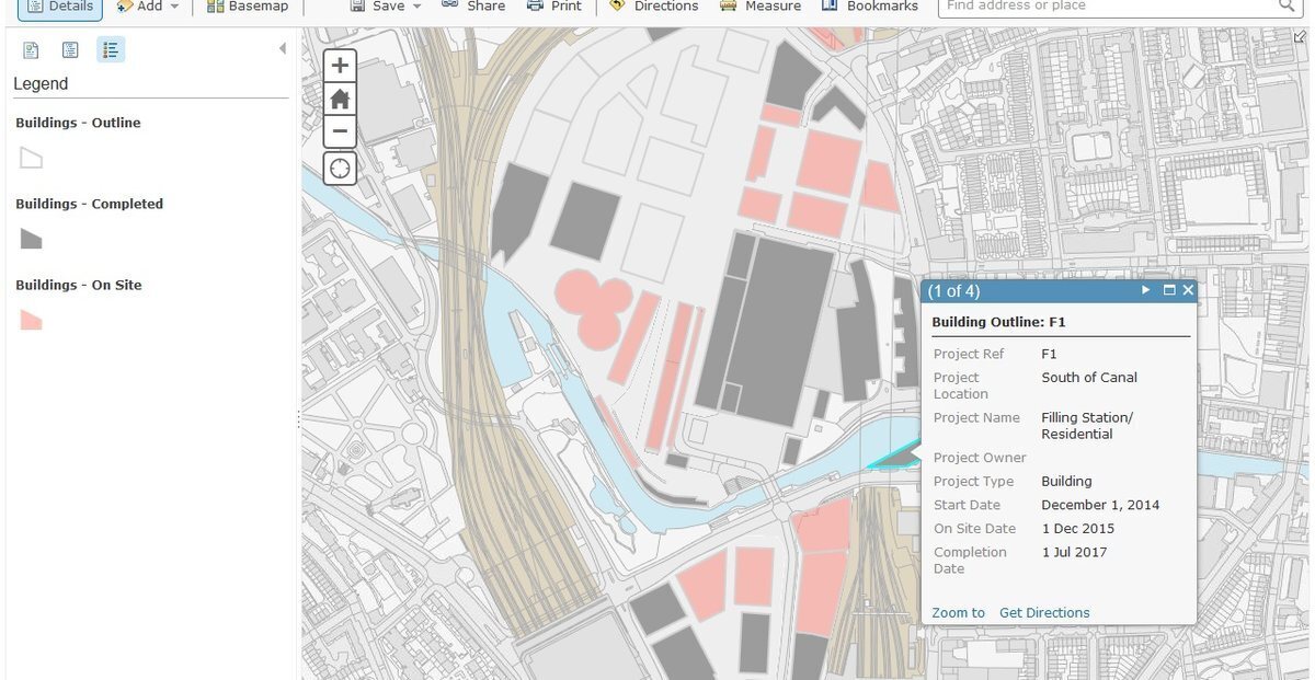
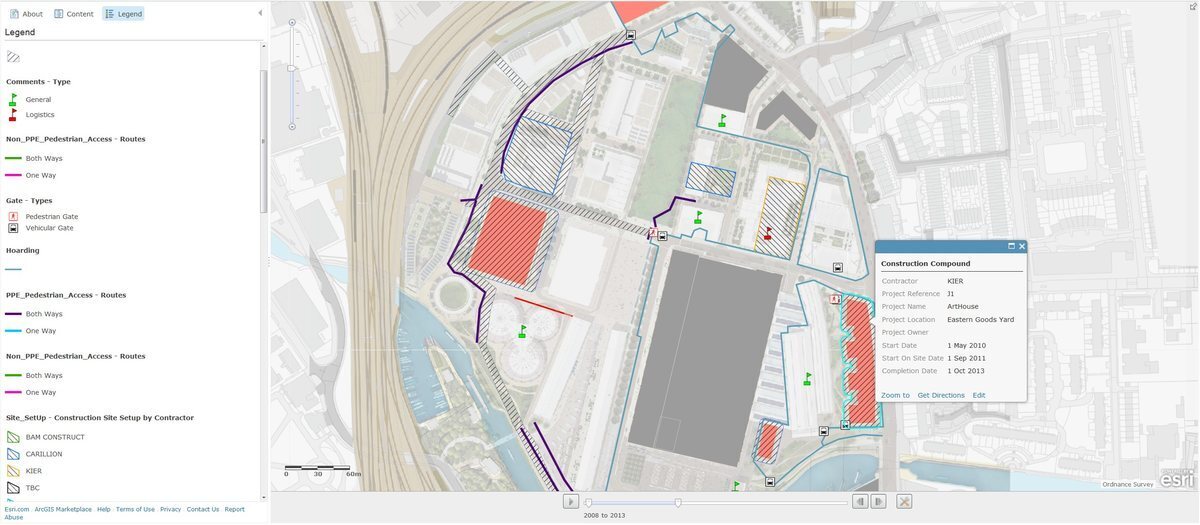
We combined new business processes with ArcGIS Desktop and ArcGIS Online, one of the very first ArcGIS Online implementations in the UK. The estate gained one accurate, shared record of every asset installed and planned, browser and mobile access on site, a time-aware phasing tool, and thematic maps such as floorspace use and estate common areas.


The outcome
The most important result was not software. It was a trusted body of information about the estate: created once, used many times. The same record fed estate management, construction logistics, phasing and the spotting of potential clashes, and business and financial decisions. Everyone, from planners and surveyors to board members, worked from the same accurate information.
“GIS is a strategic asset management tool for business planning as well as site management.”
Lilia Wydra, GIS Manager, Argent
Download the case study (PDF)Client logos are shown for identification only. Map screenshots are from the King's Cross GIS (2013 to 2014), with personal details removed.
Who we have GeoEnabled
We have worked with many organisations, from national governments and international institutions to infrastructure owners, contractors and developers.
UK central government
A strategic digital property asset register: scope, stakeholders and a roadmap to strengthen governance across government land and buildings.
Everything is Somewhere
ArcGIS Online set up for a land and property survey company, so a major UK motorsport venue could manage services, utilities, assets and tenancies through web maps.
London Underground
A geospatial asset register linking GIS with IBM Maximo, improving data accuracy, maintenance and operational response.
High Speed 1
Station asset information and facilities management for the infrastructure behind Eurostar, with lower whole-life costs.
Skanska
A review of GIS capability and a roadmap integrating GIS with BIM and asset management: one source of trusted information.
RICS
A GIS course integrating geospatial concepts with practical application, meeting a comprehensive specification.
Other organisations we have worked with include the World Bank, the Cabinet Office, Transport for London, Network Rail and Ordnance Survey.




























What clients say
“GeoEnable helped us align our information systems with optimised business processes”
Steven Eglinton, from GeoEnable, helped us review our existing information systems and align them all with optimised business processes. This was absolutely critical. GeoEnable assisted us with the improvement of information governance and formal processes, which in return significantly enhanced access to Argent's GIS and other information resources.
 Lilia WydraGIS Manager, Argent

“This has helped Esri UK increase its BIM knowledge”
Steven's knowledge of BIM is second to none. The course outlined the key principles of BIM before taking a deep dive into Government BIM standards. This has helped Esri UK increase its BIM knowledge, while enabling our staff to have detailed conversations with customers when discussing the importance of BIM and GIS workflows.
 CraigHead of Engineering, Construction & BIM, Esri UK

“Strong foundations for success”
Strategic geospatial expertise shaped the early stages of a large-scale Public Asset Register project, securing senior leader support and aligning stakeholders. Polite, focussed and intelligent input ensured effective collaboration across all levels.
Logos are shown to identify organisations we have worked with; they do not imply endorsement.
Recognised, and in practice
BSI Associate Consultant Programme. GeoEnable Limited is certified to advise on the ISO 19650 series for information management using BIM, and ISO 55001 and the ISO 55000 series for asset management. We support ISO 19650 internationally, including the UK Information Management Mandate, the IMI Framework and the UK National Annex, and the Irish BIM Mandate. We advise and train on the ISO 19100 series, INSPIRE and metadata standards such as UK GEMINI, and on ISO 27001, ISO 9001 and ISO 8000.
Esri UK training partner. We deliver BIM-GIS training with Esri UK. We are also Education and Upskilling Partners to the Construction Computing Awards.
 Free assessment
Where does your organisation stand?
Take the free GeoEnablement Assessment: 25 quick questions and a free personalised report on your organisation's geospatial maturity, strengths and next steps.
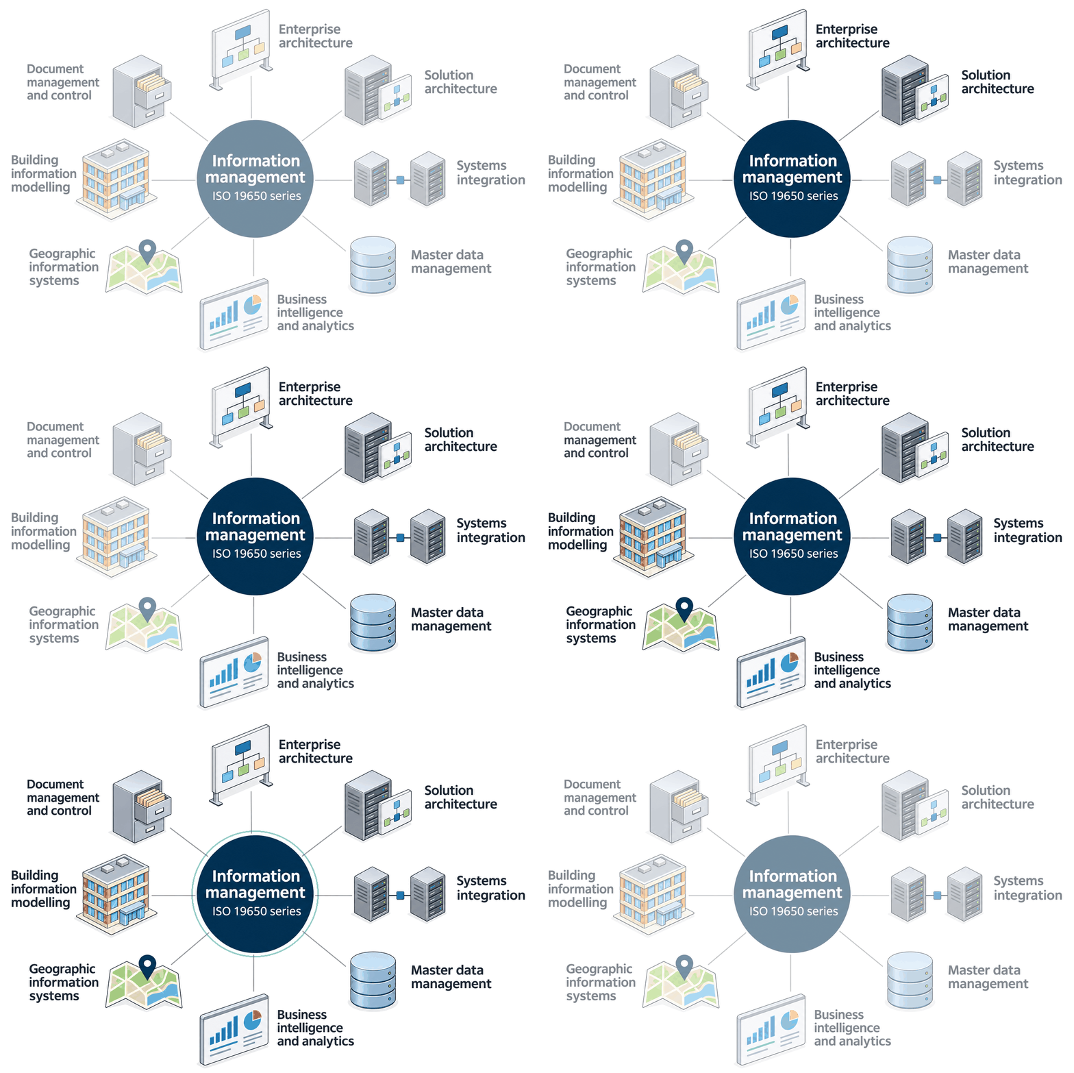
Where the disciplines meet
GIS, BIM, master data, analytics, architecture and document control all converge on one goal: trusted information.
Let's talk
Wherever you are in the world, we are ready to work with you. Start with a plan, or just tell us what you are trying to solve.

We help clients improve infrastructure and property asset management, as well as projects, using geospatial insight and digital tools. Through GIS, location intelligence, digital twins, AI and systems thinking, we enable better decisions and deliver real-world outcomes.
Quick Links

We are BSI Associate Consultants, certified in ISO 19650, ISO 55000, and experienced across ISO 19100, 27001, 9001, 8000, and the EU INSPIRE Directive.

© 2026 GeoEnable Ltd. All Rights Reserved.