
Know what you own, where it is, and what depends on it
We advise governments and public bodies on how to identify, maintain and realise more value from the public assets they own, with registers, data standards and strategies that hold up to scrutiny.

You cannot manage what you cannot see
Public estates are often recorded across dozens of spreadsheets, legacy systems and departments. Records disagree, and decisions about land, buildings and infrastructure get made on information nobody fully trusts.
Fragmented records
The same asset appears three times under three references, with three different areas and no agreed owner.
No spatial context
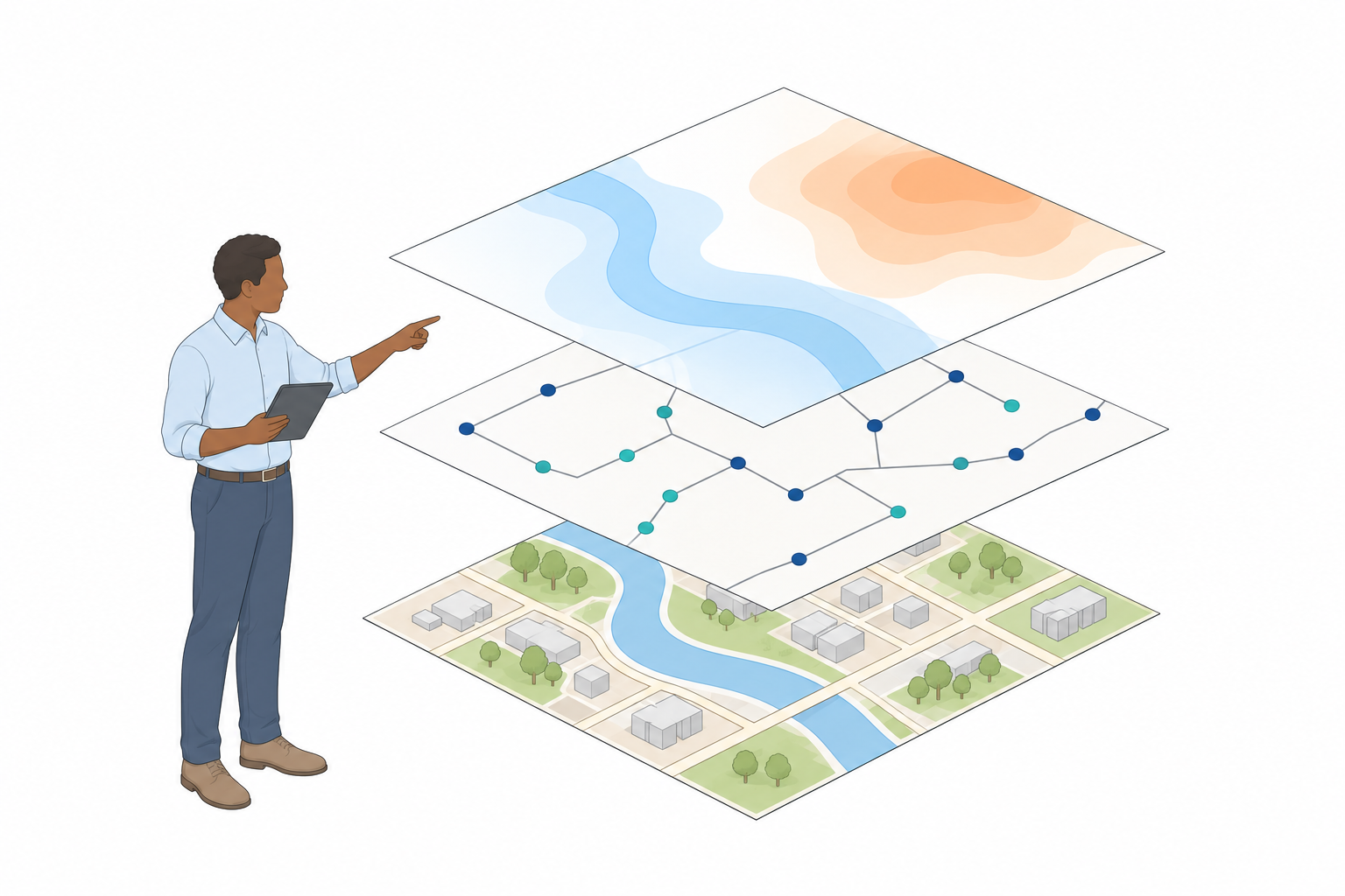
Without location, an asset register is a list. With it, you can see adjacency, overlap, risk and opportunity.
Decisions without evidence
Disposal, investment and rationalisation choices rest on data that cannot be defended under scrutiny.
Registers that are trusted and accountable from day one
At national level or across one department's estate, we define the scope, engage stakeholders and build the roadmap: asset referencing, spatial accuracy, governance and reporting that holds up to audit.
Then we raise the quality of the information itself, with geospatial standards, metadata, master data and a spatial data infrastructure, so one correction at source fixes every report downstream.
See which assets matter most, and why
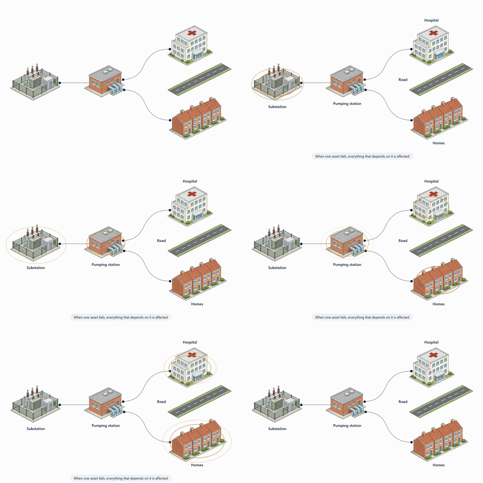
A register becomes powerful when each asset has a location and its links to everything else: the substation that feeds the hospital, the pumping station the town depends on, the road that is the only way in.
- Location: every asset on the map, with an agreed reference and accuracy
- Dependencies: what each asset relies on, and what relies on it
- Criticality: which failures would cascade, and where to invest first
The core data almost every government needs
A register rests on a small set of core datasets that everyone relies on. Most organisations already hold half of this. We help you find it, fix it and make it work together.
Where exactly?
A common positioning framework (the survey control that makes everything line up), addresses, place names and administrative boundaries.
What is built?
Buildings, roads, rail and paths, and utilities such as water, energy, telecoms and drainage, including what is underground.
What is the land like?
Terrain and seabed, rivers, lakes and coast, land cover and land use, geology and soils, and up-to-date aerial or satellite imagery.
Who, and what for?
Land parcels and ownership, population, and the services people rely on: schools, health and emergency services.
Government and national-level work
GeoEnable and the wider GeoEnable Group have advised, trained or delivered asset and information management work for public bodies and international institutions, including the World Bank, UK central government and the Cabinet Office, Transport for London, London Underground, Network Rail, Ordnance Survey and High Speed 1.
UK central government
A strategic digital property asset register: scope, stakeholders and a roadmap to improve decisions and strengthen governance across government land and buildings.
“Strong foundations for success.” Chief Data Officer, Office of Government Property, Cabinet Office
London Underground
A geospatial asset register linking GIS with IBM Maximo, giving a clear spatial view of assets that improved data accuracy, maintenance and long-term investment planning.
High Speed 1
Station asset information and facilities management for the infrastructure behind Eurostar, strengthening governance and reducing whole-life costs.
Resilience, sustainability and the value you already own

Resilience
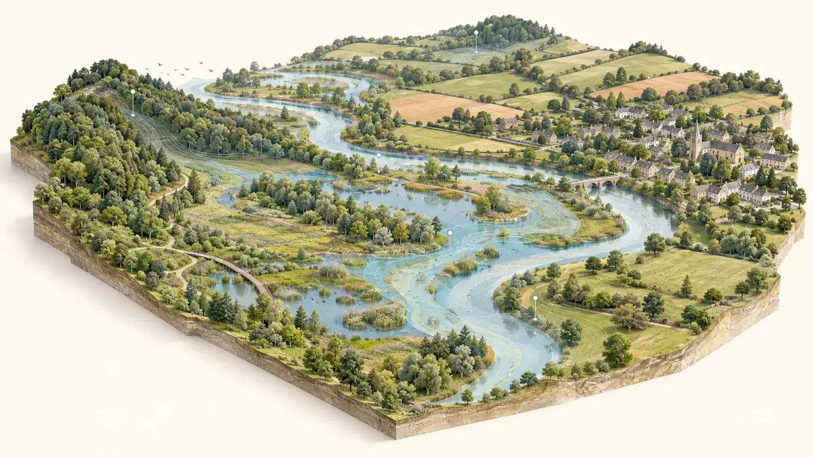
A spatial register shows which assets sit in flood zones, which serve critical functions, and where one failure cascades.
Sustainability
Carbon, energy and biodiversity targets become measurable when they are tied to real places, and can be evidenced rather than asserted.

Unlocked value
Surplus land found, underused buildings rationalised, co-location opportunities spotted. The value is usually there already; the information is what's missing.
Better public asset information also helps governments show progress on the UN Sustainable Development Goals, especially on sustainable cities and communities, and industry, innovation and infrastructure.
Land, water, woodland and peat are assets too
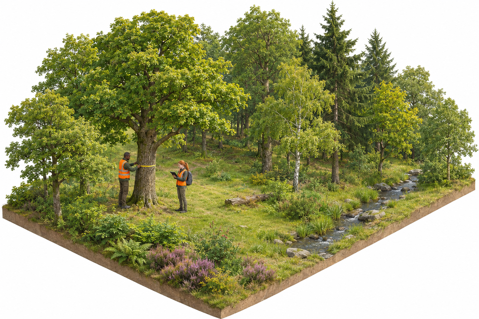
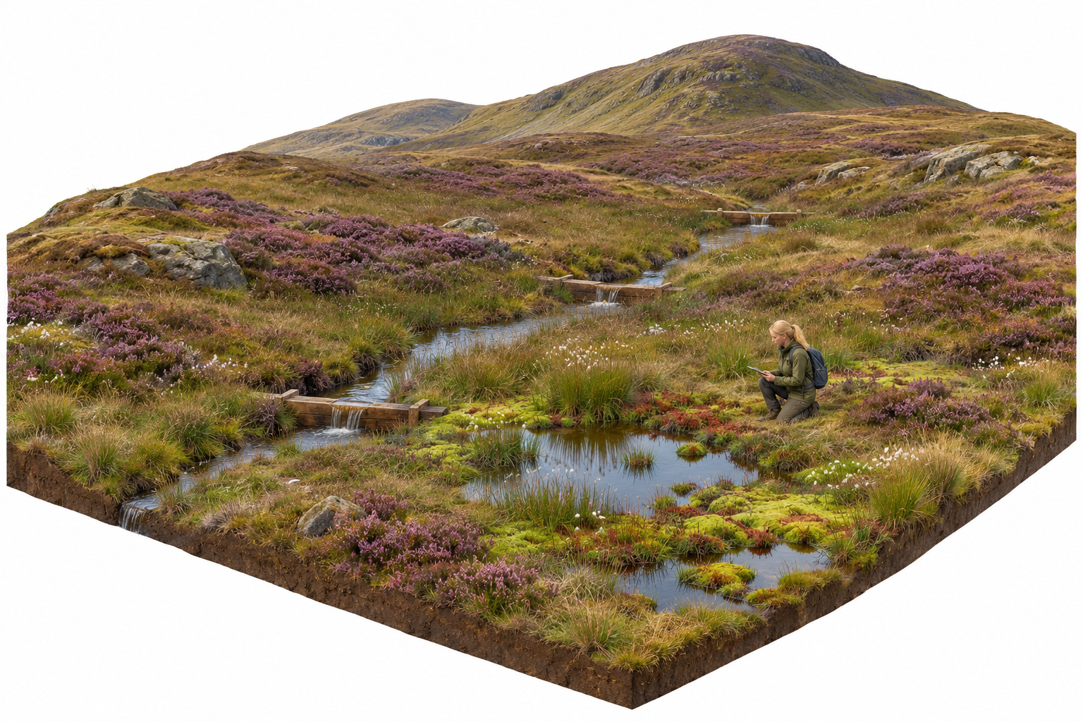
A public estate is more than buildings and roads. Woodland, rivers, wetlands and peat store carbon, hold back floods, clean water and support wildlife. Mapped and monitored like any other asset, they can be managed, valued and reported on.
Woodland and trees
Map every woodland and tree belt, record its species, condition and change over time, and see the carbon it stores and the habitats it links up.
Peat, wetlands and water
Healthy peat locks away carbon and slows water running off the hills. Mapping its depth and condition, and monitoring restoration, shows where the work pays back most.
Held in the same register, on the same standards, as the rest of the estate, this information supports climate and nature targets, from net zero and nature recovery to the UN Sustainable Development Goals on climate action and life on land.
Geospatial in natural capital: measured the same way, every time
Every natural asset has a location, so natural capital reporting is a geospatial job. The difficulty today is not a lack of data but too many different ways of measuring it: two teams can map the same woodland and report different answers. Lenders, insurers, government and planners increasingly need nature figures they can compare and trust.
- One consistent baseline. Agree what is measured, how, at what scale and how often, so results can be repeated and compared over time.
- Measure, monitor, evaluate. A clear cycle of mapping, change detection and review, with the evidence kept alongside each figure.
- Common spatial standards. Shared data models, metadata and open standards, so information moves cleanly between owners, consultants and regulators.
- Ready for disclosure. Location-based evidence for nature-related financial disclosures (for example the TNFD recommendations), carbon and woodland reporting, and biodiversity net gain in planning.
In plain terms: natural capital is the stock of natural assets, such as soil, water, woodland and wildlife, that provide services people rely on. TNFD (the Taskforce on Nature-related Financial Disclosures) sets out how organisations report their nature-related risks and impacts. Biodiversity net gain is the requirement in English planning for development to leave habitats in a measurably better state than before.
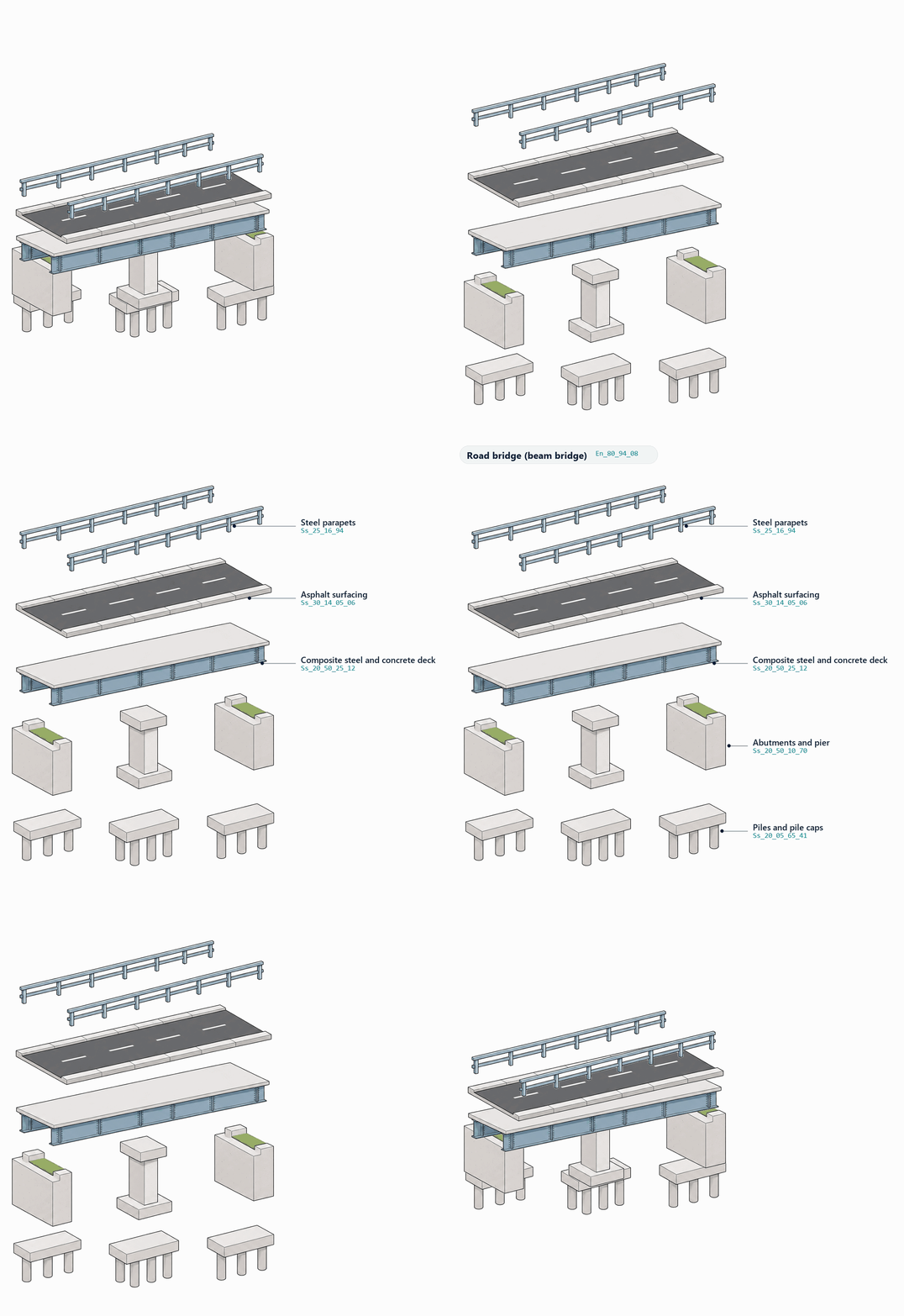
An asset register goes down to the parts
A bridge is many assets in one: foundations, piers, deck, surfacing and parapets, each with its own classification and record.

We help clients improve infrastructure and property asset management, as well as projects, using geospatial insight and digital tools. Through GIS, location intelligence, digital twins, AI and systems thinking, we enable better decisions and deliver real-world outcomes.
Quick Links

We are BSI Associate Consultants, certified in ISO 19650, ISO 55000, and experienced across ISO 19100, 27001, 9001, 8000, and the EU INSPIRE Directive.

© 2026 GeoEnable Ltd. All Rights Reserved.